

Every tree in your urban forest gets a persistent digital record capturing species, structural condition, geolocation, and full lifecycle history — built for long-term tracking, not one-time audits.
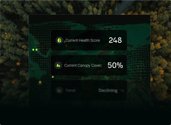
Continuous remote assessment of canopy cover, leaf area index, and stress indicators using multispectral imagery and machine learning — delivering real-time health scores across the entire fleet.
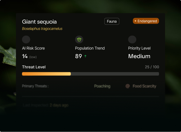
Our risk engine scores each tree's likelihood of structural failure by fusing inspection data, weather events, and species-specific decay models — so your teams act before incidents happen.
Automated sequestration calculations turn your urban forest into a quantified carbon asset. Generate audit-ready reports and connect directly to carbon markets and sustainability frameworks.
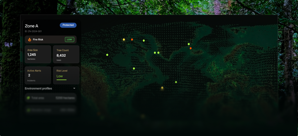
A city-wide spatial intelligence layer that overlays tree data on live basemaps — enabling planners to model canopy equity, prioritise planting zones, and track change over time.
Designed for Real World Operations
Trees and green assets are identified and recorded through field surveys, imaging, or AI-driven detection.
Each tree is given a unique digital record encompassing its location, species, condition, and history in one reliable system.
Individual tree records are linked across larger and mapped against environmental patterns, overlays and areas of concern.
AI-driven analytics continuously evolve to reflect changes in health, risk, and interventions.
Clear reports and summaries support planning, maintenance, and compliance — with exportable reporting based on measurable data.